Showing posts with label GIS. Show all posts

Wednesday, June 11, 2008

OnTheMap

I learned of the Census' OnTheMap service which lets you analyze employment at a local level from an area workforce report. Although the service is not quite as intuitive as many Google Maps or Microsoft Live maps, it does provide some useful data. You have a variety of options for report generation. For example, you can create a set of concentric circles, such as this map of Logan, Utah with 1, 2, and 3-mile radius around the city center.

Then you can generate a report for employment data within each of the circles, like this:

The load times are long, but you can export the data to a variety of formats for reuse. Seventeen states are listed as participating partners. Utah is not one of those.

Thursday, June 05, 2008

A Virtual 3D Experience

Have you explored Google Earth recently? I have a hard time leaving a browser for other applications, but it is getting more compelling. Take a look at this view of Salt Lake City.
Those green dots are real-time traffic points communicating current freeway speeds. You also have temperature reports in real-time from around the city. The blue dots are images. You can add an incredible amount of other data, even YouTube videos or Twitter posts from locations around the city. Another layer will pull up relevent Wikipedia information found on the 3-D map. There are innumerable additional layers such as NY Times and Google News that associate any news from those sources with points on the map. I met with some people from the Center for Active Sensing and Imaging at USU this morning who have a new LIDAR system for 3-D imaging that will automate the creation of 3-D aerial and ground imagery, doing some very cool stuff that will contribute to the full enablement of the 3-D virtual world. This is one of the new USTAR teams that you will find on innovationutah.com.

Now, take a look at Monster Milk Truck. Google lets you drive the truck anywhere you want to go in the terrain. It won't be long before your avatar will be able to wander the virtual earth at will. Then, we can integrate key functions between the real and virtual worlds, letting your avatar control specific real world functionality. How about that?

Wednesday, March 05, 2008

Last Day of the Legislative Session


There is always lots of activity on the last day of the legislative session and today is no exception. House and Senate are both working their way through lots of remaining bills. Seems like half of the legislators are losing their voice today. Good luck to Reps. Clark and Holdaway on regaining their voices. Still waiting to see what happens to HB426 and SB38. 365 bills (one for every day of the year) have passed so far this year.

There were some very good presentations at Network World's IT Roadmap conference I attended yesterday. We are working on ideas to improve what we do locally and sharing some of the best ideas from the conference.

I also learned about Bungee Labs from a Twitter post. Bungee Labs is a SLC-based company that provides a SDDS - Software Development and Deployment as a Service. Here's a good overview from ZDNet.

New NASCIO paper on IT Governance and Business Outcomes with a couple of good Utah contributors.

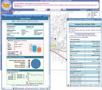
The US Department of Education has a new map service (see above image) for their School District Demographics System (there's that SDDS acronym again). I just wish you could access a KML file for any map you produced with this ESRI service. That would be really nice.

See the March Issue of Governement Technology for the top Dreamers and Doers in gov IT. Also includes an article on what governments are doing with virtualization. We've been virtualizing servers for 4-5 years now with VMWare. Last night, I sat next to the Citrix rep on the airplane and had a good discussion on their various XEN products.

Clarification: Senator Hickman made some comments with respect to Senate Bill 38 (listen to audio files), Transparency in Government when discussing the Public Meeting Notice website about software developers taking 18 months. Requirements were passed to the developers in October. The development of this site actually took less than 5 months. It is in testing now and will be ready to go live on April 1st as required. Local governments requested a delay so that they can prepare to enter data in the system, train their people, etc. Something like 2,000 public entitities will use the system.

Thursday, February 14, 2008

Google Streets on the Wasatch


Google Streets now covers most of the Wasatch Front, from Perry to Santaquin (fruit row to orchard town). I can't imagine how many hours were spent imaging so many streets, but I am certainly impressed. Now we can only imagine how this vast amount of data might be leveraged in the future.

Monday, December 17, 2007

Modeling Our Local Communities

As I was thinking about what we should be doing with KML, I came upon Google's community modeling initiative using Sketch-Up. I thought, "We need to develop a collaborative initiative to begin modeling Utah's communities", then I discovered that Google has already created a model of the Utah State Capitol., the thing that I thought should be first on the to-do list. So, now that the first thing is done, we can start on the next. Well, then I discovered that quite a few more are already done, including The Gateway Shopping Center, Deseret National Bank Building, the Salt Lake Public Library, the Energy Solutions Arena, the Salt Palace Convention Center, the Wells Fargo Center, even the New Harmony Library. Someone has also modeled many of the buildings at Utah State University. So, that gives us a good start. The next step is to set up local collaborative city modeling efforts like these. When this is complete, we will be on our way to enabling the creation of a more virtual world. Here are the steps to begin. I have photos that I have been collecting of many Utah government buildings, so I'll get started soon.

City modeling of some of my favorite places:
This map gives you a great tour of where the most recent modeling activity is happening.

Friday, December 14, 2007

KML in Government

I think we need to support the KML standard for geographic data exchange the same way we have RSS. I presented a simple demonstration of this in our statewide product management council. Take this kml file of Cache County (right-click and copy link location) and go to maps.google.com and paste the URL into the map search field. Voile, you have a map of Cache County that you can then supplement with your own personal data or with other information from the web.

View Larger Map

I also love the new terrain map feature that Google recently introduced. Here's a look at the terrain around Wasatch Mountain State Park:


View Larger Map

We've had some discussions about this with the state's Automated Geographic Reference Center and it appears that they will be able to create KML files from the SGID without too much effort. When you combine that with what they are already doing with webservices and some of the new mapping services on mapserv.utah.gov, like this map of the Farmington Cemetery, you see that the possibilities are endless in terms of producing GIS data that is much more friendly and reusable by the lay public.

Friday, July 27, 2007

Batch Geocoder

As you know, I am a big fan of GIS. Batch Geocoder is the kind of service that every state needs to have available. In five minutes, I was able to geocode a large dataset and create an interactive map. The service allows you to copy and paste data from a spreadsheet, then associate the location fields. That's about all there is to creating the map. The online version does have its limitations. In this map of Utah-licensed realtors, you only can see the first 200 records, Batch Geocoder does not allow you to show more. If we offered a similar service to state and local agencies, I think we'd see a lot more interactive maps and services available online.

Monday, December 18, 2006

GIS Everywhere

Almost every day, we're seeing new, interesting GIS applications and services online. Flash Earth provides a powerful interface into a variety of other tools, including OpenLayers: